| Home | | | Work | | | Exhibitions | | | Publications | | | Articles | | | Information | | | Contact | | |
Chrystel Lebas
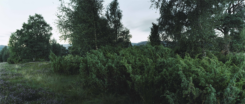
Re-visiting 2011- In 2011 the Natural History Museum London commissioned me to make new work inspired by a collection of anonymous glass negatives depicting the British landscape, from the beginning of the 20th century. Chromogenic prints from colour negatives, variable sizes and gelatin silver prints printed from Salisbury’s original glass plate negatives
|
||||
 |
 |
 |
 |
|
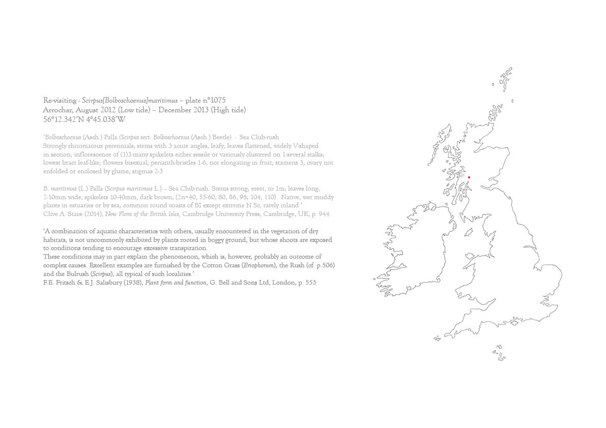
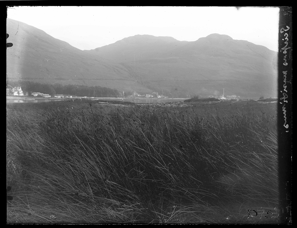
| Edward James Salisbury. From box 1075-1079-Arrochar 1928. Scirpus[Bolboschoenus]maritimus. Plate n°1075 |
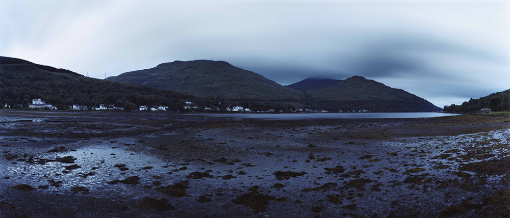
Re-visiting Scirpus[Bolboschoenus]maritimus Plate n°1075, Arrochar, August 2012 (Low tide) 56°12.342’N 4°45.038’W |
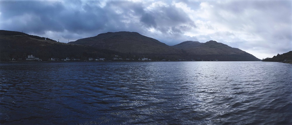
Re-visiting Scirpus[Bolboschoenus]maritimus Plate n°1075, Arrochar, December 2013 (High tide) 56°12.342’N 4°45.038’W |
||
 |
 |
 |
 |
|
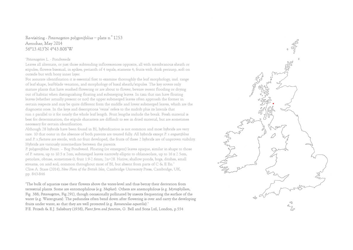
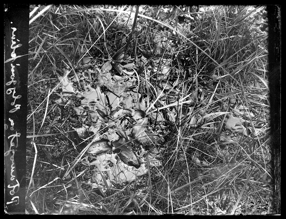
| Edward James Salisbury. From box 1250-1258-Arrochar 1928. Potamogeton polygonifolius. Plate n°1253 |
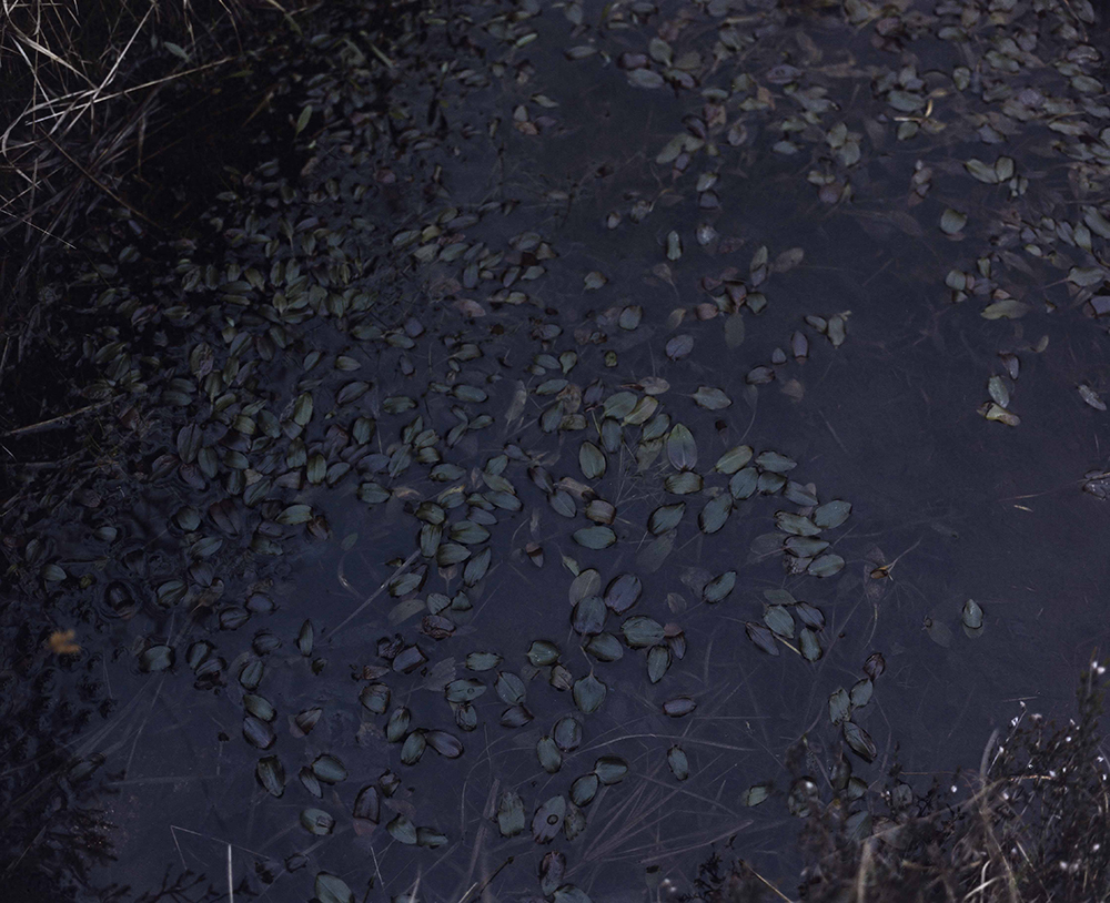
Re-visiting Potamogeton polygonifolius Plate n°1253, Arrochar, May 2014 56°13.413’N 4°43.808’W |
Re-visiting Loch Long from Glen Loin, No Plate, Arrochar, May 2012 56°14.298’ N 4°43.905’ W |
||
 |
 |
 |
 |
|
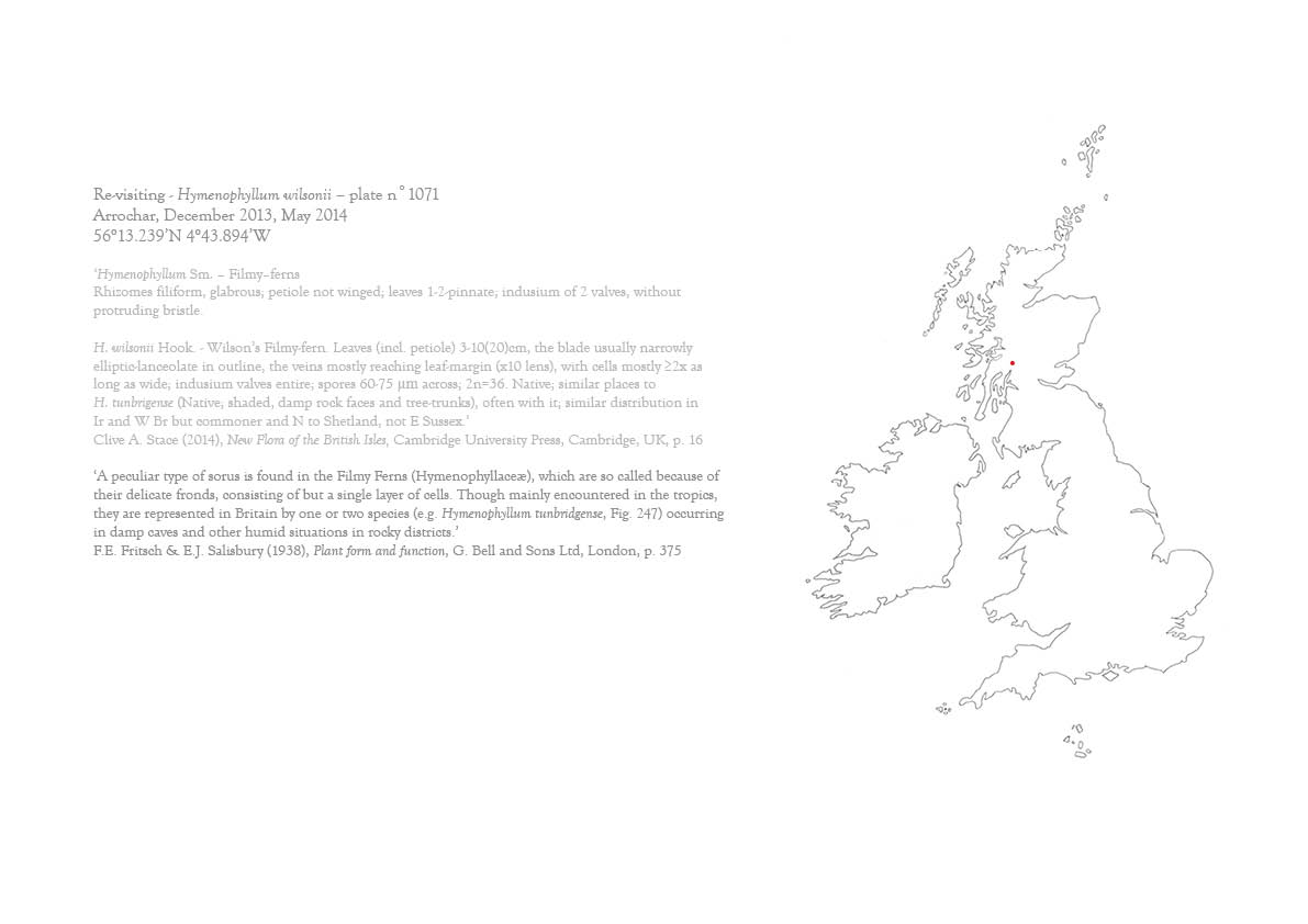
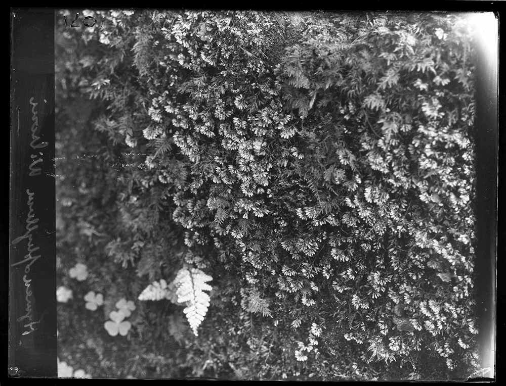
| Edward James Salisbury. From box 1070-1079-Arrochar 1928. Hymenophyllum wilsonii. Plate n°1071 |
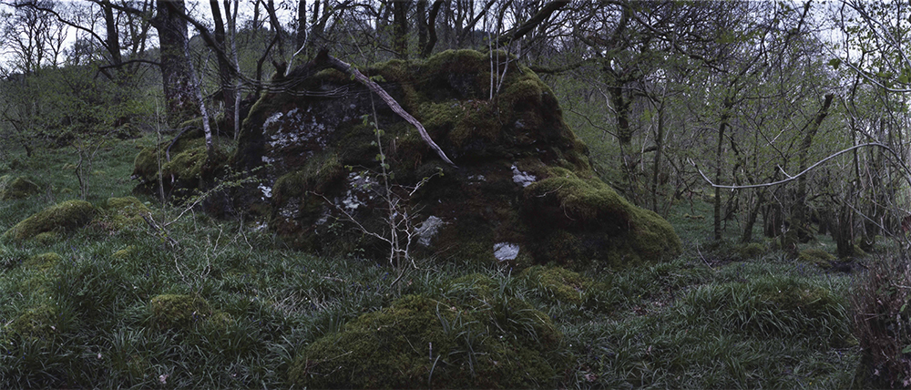
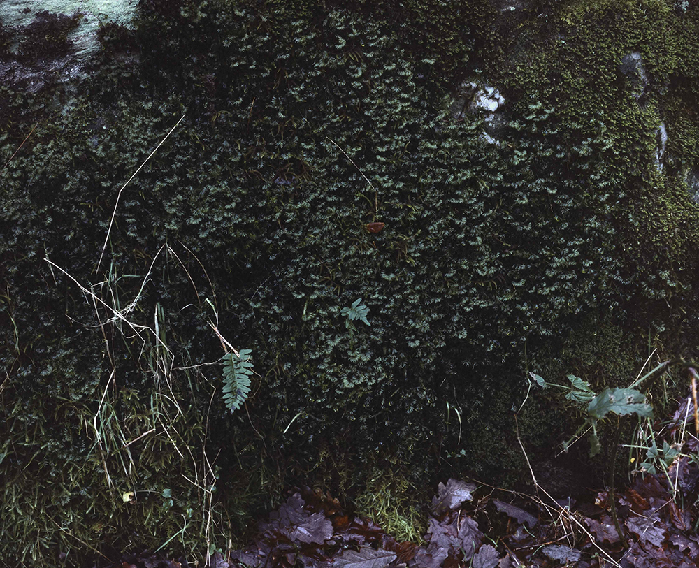
Re-visiting Hymenophyllum wilsonii Plate n°1071, Arrochar, May 2014, 56°13.239’N 4°43.894’W |
Re-visiting Hymenophyllum wilsonii Plate n°1071, Arrochar, December 2013 56°13.239’N 4°43.894’W |
||
 |
 |
 |
||
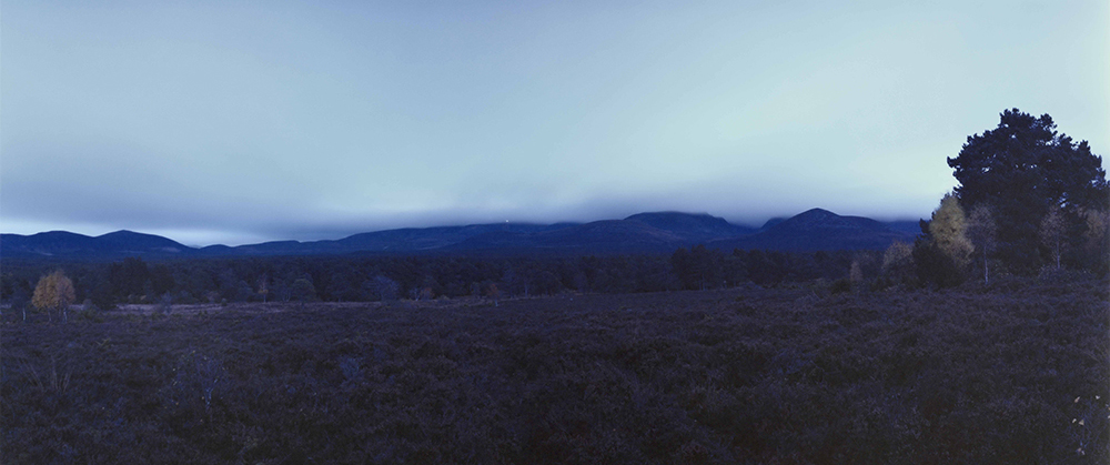
| Edward James Salisbury. From box 1250-1258-Arrochar 1928. Ben Vorlich from Glen Loin. Plate n°1252 |
Re-visiting Ben Vorlich from Glen Loin Plate n°1252, Arrochar, December 2013 56°13.865’ N 4°43.862’ W |
Re-visiting Ben Vorlich from Glen Loin Plate n°1252, Arrochar, August 2012 56°13.865’ N 4°43.862’ W |
||
 |
 |
 |
 |
|
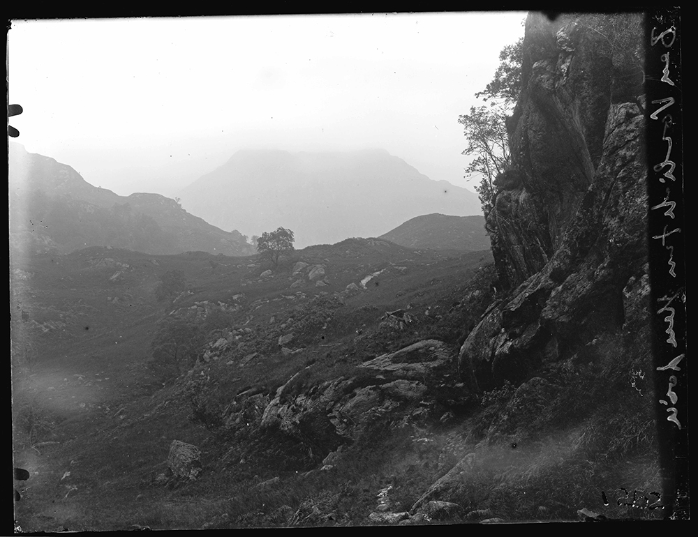
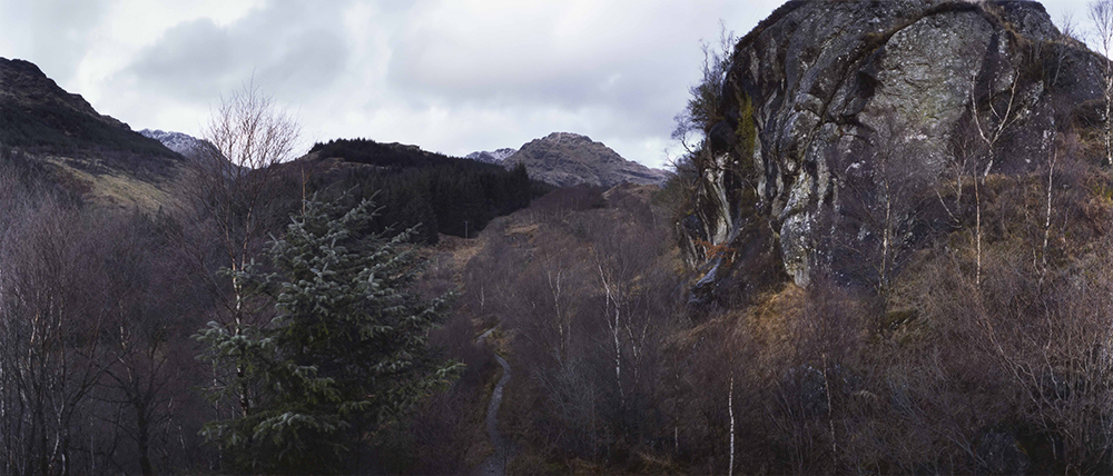
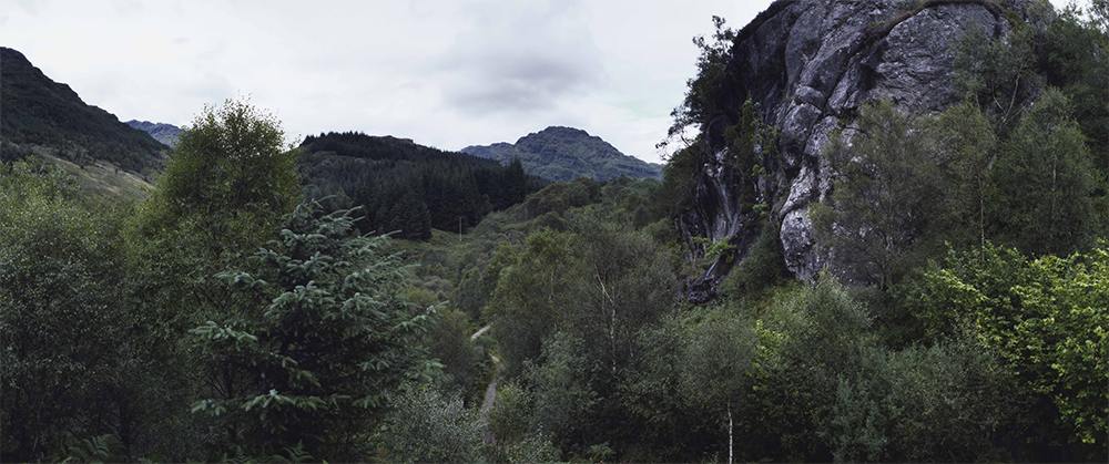
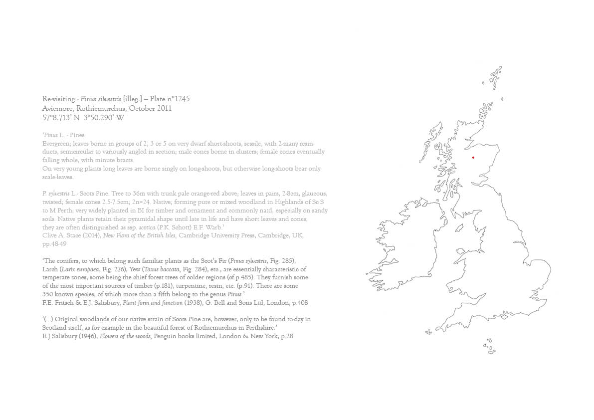
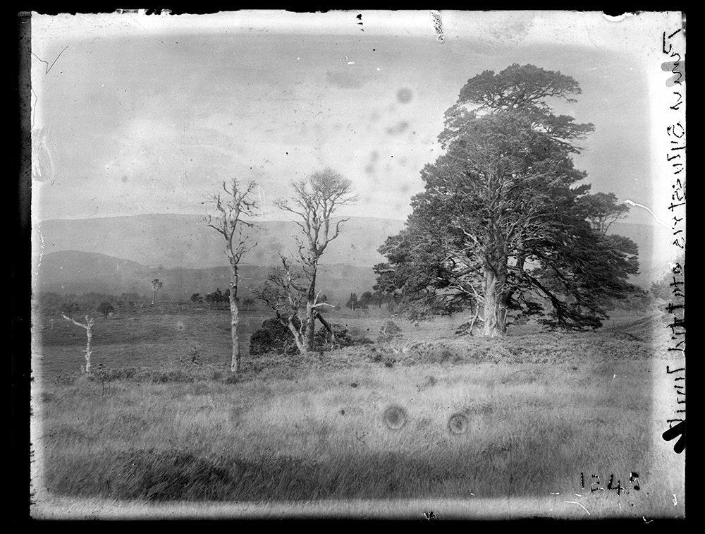
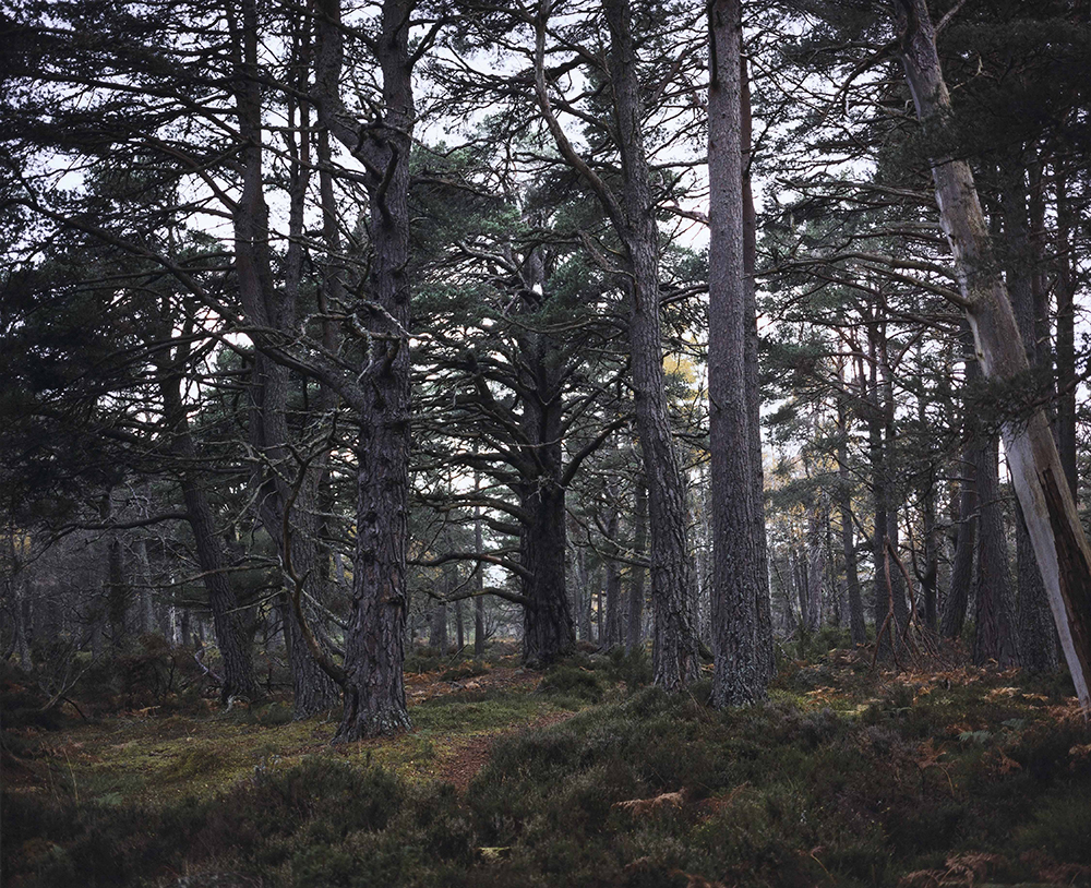
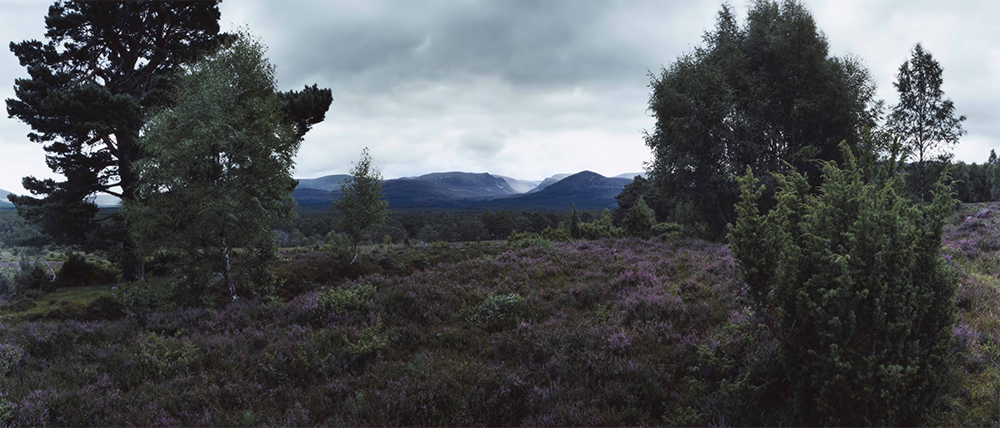
| Edward James Salisbury. From 1237-1249-Aviemore. Pinus silverstris [illeg]. Plate n°1245 |
Re-visiting Pinus silvestris [illeg.] Plate n°1245, Aviemore, Rothiemurchus, August 2012 57°8.691’ N 3°50.304’ W |
Re-visiting Pinus silvestris [illeg.] Plate n°1245, Aviemore, Rothiemurchus, October 2011 57°8.713’ N 3°50.290’ W |
||
 |
 |
 |
 |
 |
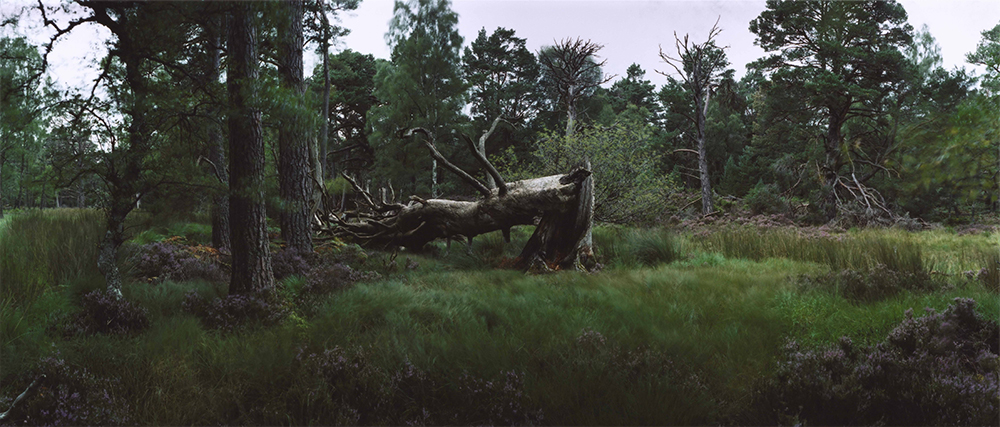
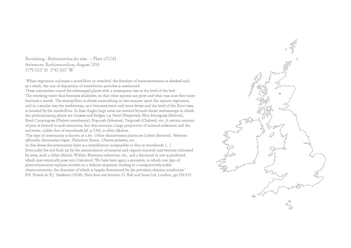
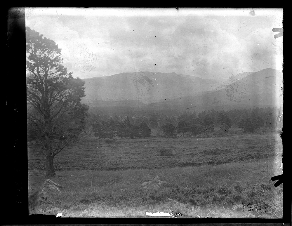
| Edward James Salisbury. From box 1237-1249-Aviemore. Rothiemurchus fen view. Plate n°1241 |
Re-visiting Rothiemurchus fen view Plate n°1241, Aviemore, Rothiemurchus, August 2012 57°9.577’ N 3°47.777’ W |
Re-visiting Rothiemurchus fen view Plate n°1241, Aviemore, Rothiemurchus, October 2013 57°9.527’ N 3°47.467’ W |
Re-visiting Rothiemurchus fen view Plate n°1241, Aviemore, Rothiemurchus, August 2014 57°9.555’ N 3°47.505’ W |
|